0151 355 3160
sales@leighstationers.co.uk

Sale
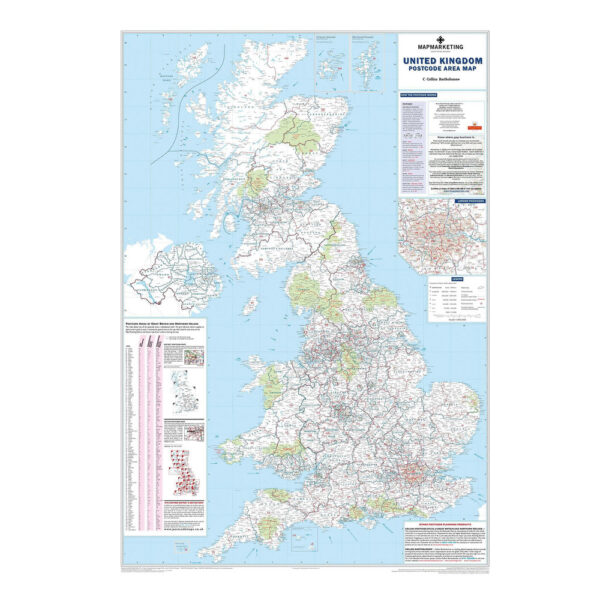
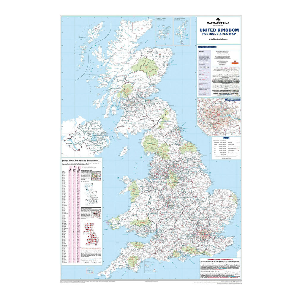
Map Marketing UK Postcode Areas Laminated Map BIPA MM90301
£32.20
Please note we don’t always carry Website items in the store, please confirm stocks prior to checkout, and don’t hesitate to call us or email us if you have any questions
Call 0151 355 3160 or email the team at sales@leighstationers.co.uk
[We might alternate between suppliers for the best price so it will be a different brand sometimes]
For inks and cartridges
Please call us to confirm this cartridge fits your machine
UK Postal Area map, postcode map

This map shows the clear boundaries of every postcode area, plus their corresponding letters, and includes a handy index to rapidly find any postcode area on the map by letter. It also provides information on the structure of a postcode for reference. It also provides boundaries for counties and unitary authorities, correct as of the most recent adjustments from 2009.
- A laminated map of UK postcode areas, counties, and unitary authorities
- Shows postcode area boundaries and corresponding letters
- Shows roads, motorways, and settlements from 2,000 to 1 million-plus
- Includes London inset and handy postcode locator
- Measures 1200 x 830mm, scale 1:800,000
- 2011 edition: includes 2009 administrative changes
| Weight | 60 g |
|---|---|
| Dimensions | 1000 × 570 mm |


You may also like...

 Map Marketing UK Postcode Area...
£32.20