0151 355 3160
sales@leighstationers.co.uk

Sale

Map Marketing British Isles Motoring Laminated Map BIM
£32.20
Please note we don’t always carry Website items in the store, please confirm stocks prior to checkout, and don’t hesitate to call us or email us if you have any questions
Call 0151 355 3160 or email the team at sales@leighstationers.co.uk
[We might alternate between suppliers for the best price so it will be a different brand sometimes]
For inks and cartridges
Please call us to confirm this cartridge fits your machine
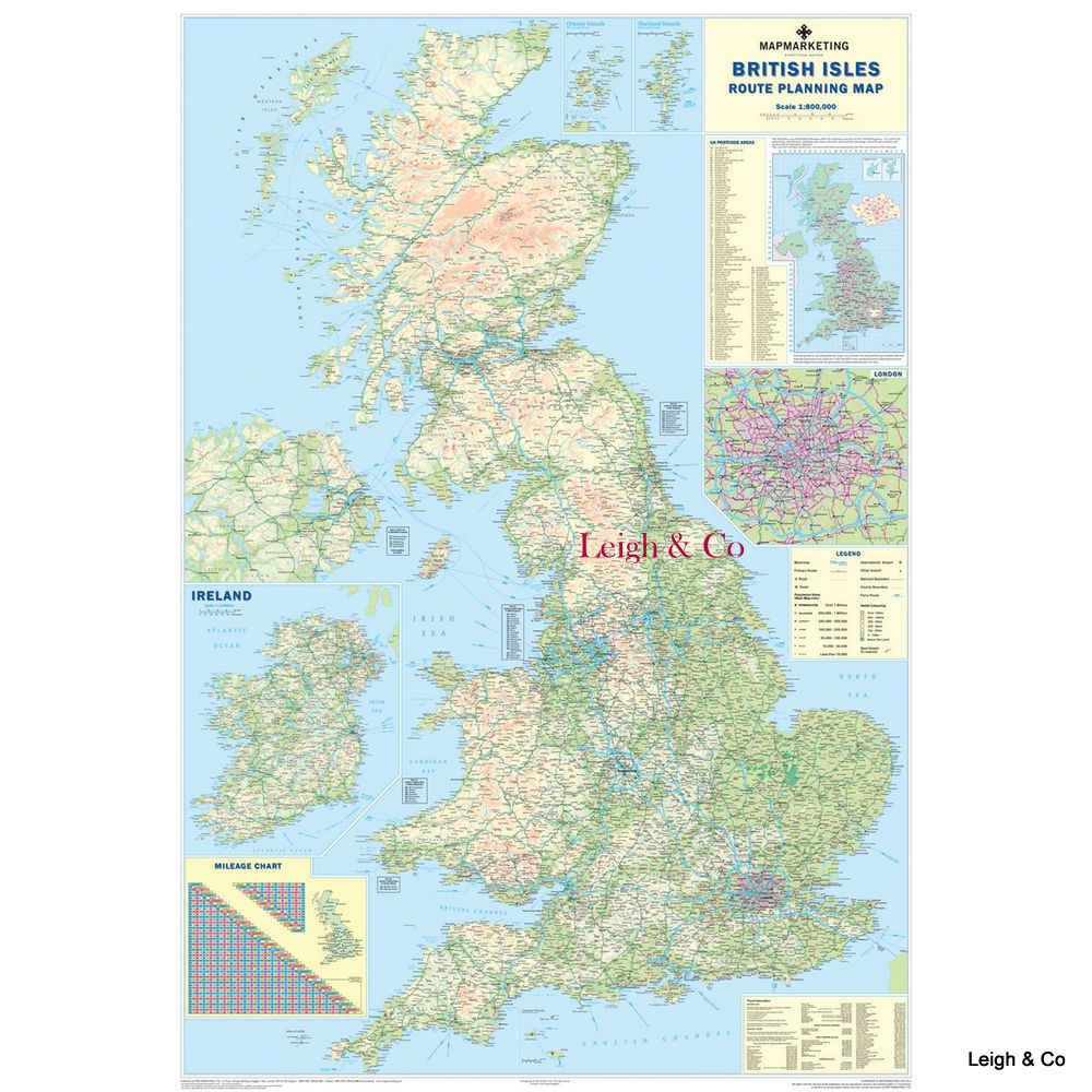
British Isles Motoring Laminated Map


With every motorway and A-road included, plus shaded relief colouring for terrain, it’s a handy addition for home or office. Inset boxes cover roads within London, a smaller-scale map of Ireland, and postcode areas. Plus, there’s two useful mileage charts display distances between 48 UK and 18 Irish places. It’s laminated to allow you to add annotations in drywipe pen and protect against any unplanned spillages or leaks. This map also boasts a scale of 1:800,000.
- Laminated map of UK and Republic of Ireland road network
- Shows motorways, A-roads, and B-roads within M25
- Inset with rail, ferry and airport phone numbers
- Mileage chart with distances between 66 major towns and cities
- Measures 1200x830mm, scale 1:800,000
- 2011 edition: includes 2009 administrative changes
| Weight | 60 g |
|---|---|
| Dimensions | 1000 × 570 mm |


You may also like...

 Map Marketing British Isles Mo...
£32.20